Skip to content
  • Catalogue
  • Dictionary of Irish Architects
  • Catalogue
  • Dictionary of Irish Architects
Menu

Menu

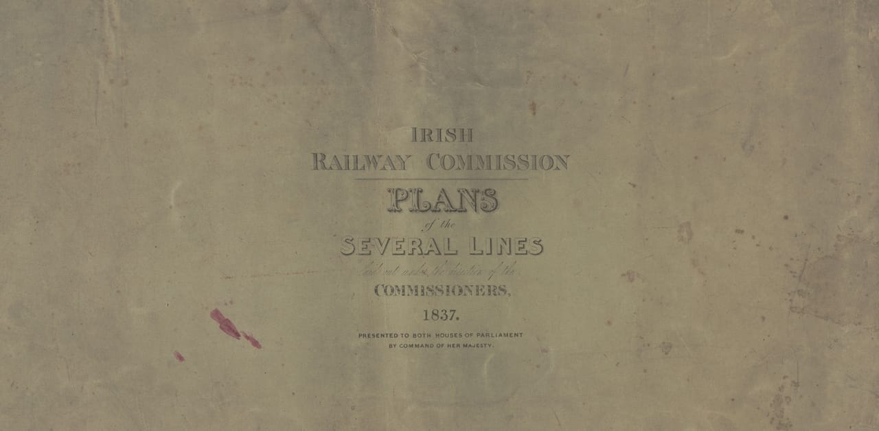
Cover of Irish Railway Atlas, 1837.

Plans of the Several Railway Lines in Ireland

Irish Railway Commission

1837

Printed atlas

IAA Institution of Engineers of Ireland Collection 2005/95.5381

Building for Transport II: Railways

Plans of the Several Railway Lines in Ireland

Irish Railway Commission

1837

Printed atlas

IAA Institution of Engineers of Ireland Collection 2005/95.5381

The first public railway in Ireland, the 8-mile line linking Dublin and Kingstown (Dun Laoghaire), opened in 1834. To capitalise on its success, in 1836 parliament established a Commission to ‘inquire into the Manner in which Railway Communications can be most advantageously promoted in Ireland’. The commissioners – Chairman Thomas Drummond’s (1797–1840), (after whom the commission is sometimes named), John Burgoyne (1782–1871), Peter Barlow (1776–1862), and Richard Griffth (1784–1878) – were all experience engineers and administrators. Their first report was issued in 1837, accompanied by this atlas showing the routes of the two principal lines which the Commission advocated should be built. The southern line, set out by engineer Charles Vignoles (1793–1875), was to run from Dublin to Maryborough (Portlaoise), then via Thurles to Holycross, Cashel, Mallow and Cork. Branch lines would connect to Kilkenny, Limerick and Waterford. The northern line, laid out by John Macneill (1793–1880), was to run from Dublin through Navan, Carrickmacross, and Castleblaney, to Armagh and on to Belfast. From Navan, a second line would run via Kells, Virginia, and Cavan to Enniskillen.

The Commission issued a second and final report in 1838. In setting out the analytical and statistical justifications for the chosen routes, the Commission provided a comprehensive account of the economic and social state of the island, including a prescient warning about the overreliance of a large percentage of the population on the ‘wet and tasteless’ lumper potato (Second Report of the Irish Railway Commissioners (London, 1838), 117). By ‘affording present employment to vast numbers of the people, and by throwing open resources and means of profitable occupation’, the railways, the Commission proclaimed, would be panacea to many of the country’s ills (Second Report, 121).

Despite being generally favourable received, the Railway Commissions vision of a comprehensive centrally planned railway system in Ireland was never realised. The development of railways across the island was left instead of the vagaries of private railway companies.
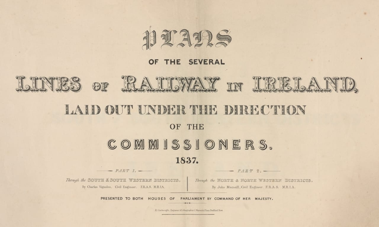
9.1 Plans of the Several Railway Lines in Ireland, Railway Commission, 1837 (IAA Institution of Engineers of Ireland Collection 2005/95.5381). Title page

The Irish Railways Commissioners and their plans

Siobhan Osgood


The arrival of railways in Ireland was far from straightforward, with parliament paralysed by its frugal grip upon Irish expenditure. The first Irish railway authorised by a Parliamentary Act was the Limerick and Waterford Railway in 1826, while the first railway line, the Dublin and Kingstown Railway, opening in 1834. Further petitions followed but, to prevent the speculative building of lines, all had to await the outcome of a Government report into their viability. The Plans of the Several Lines of Railway in Ireland accompanied the first and second Reports of the Commissioners Appointed to Inquire into the manner in which Railway Communications can be most Advantageously Promoted in Ireland. The first report was presented to parliament in 1837 followed by the second, more complete, report in 1838.

The Commission was led by Thomas Drummond (1797–1840), engineer and Under-Secretary for Ireland. He was joined by Colonel John Fox Burgoyne (1782–1871), appointed colonel commandant of the Royal Engineers in 1854, Peter Barlow (1776–1862), Professor of Mathematics at the Royal Military Academy at Woolwich, and Richard Griffth (1784–1878), geologist and civil engineer. Captain Henry David Jones (1791-1866) was Secretary to the Commission, while Lieutenant Henry Drury Harness (1804-83) of the Royal Engineers and Instructor of Fortification at Woolwich, and Lieutenant Thomas Larcom (1801-79) of the Royal Engineers and the Irish Ordnance Survey assisted.

The purpose of the Commission was to conduct and present surveys of proposed railway lines and the best means of directing their development; in particular to determine the routes where the greatest advantages might be obtained with the smallest outlay. Advances in steam-packet ships to America were to be investigated alongside the potential of providing railway connections to ports on the west or south coast of Ireland. The Commission endeavoured to distinguish between those lines which ought to be enforced by legislative enactment and those which might be left to the fancy or ‘sagacity’ of Directors of Railway Companies.

The first report included an account of the Commissioners’ inability to complete their tasks due to the lack of sufficiently accurate maps of Ireland. This offered a very serious impediment to progress, with existing maps being ‘extremely incorrect, often, purely fanciful’ and of very ‘considerable embarrassment’. They were, however, able to rely on the maps of nine northern counties which, by 1837, Colonel Thomas Frederick Colby (1784-1852) and the Ordnance Survey Department for Ireland had produced, while a larger map of the whole island drafted for the Commissioners by Lieutenant Larcom was judged ‘far superior to any hitherto constructed’. They also used Richard Griffith’s as yet unpublished Geological Map of Ireland, a copy of which accompanied the second report. Griffith’s map highlighted expansive limestone deposits which made up the most important and characteristic forms of the country, and showed the landscape was generally free from elevated ridges thus presenting favourable levels, and excellent materials for works.

The second report detailed two lines which the Commissioners recommended be constructed from Dublin; one northward to Armagh, the second south-westward to Limerick and Cork. The task of delineating these was contracted to two ‘eminent engineers’: Charles Blacker Vignoles (1793–1875) for the south and south-western routes, and John Bemjamin Macneill (1793–1880) for the north and north-western districts. Their findings were illustrated in Plans of the Several Lines of Railway in Ireland which contained twenty-nine maps with colour-coded track lines showing suggested routes. This was printed by the engraver and lithographer R. Cartwright of Bedford Row, London, who demonstrated his finesse with an ornate window-display of fonts on the title page (9.1). Maps were reproduced using the engraved intaglio technique, with colours overlayed using chromolithography. Numerous copies of the Plans were printed, although the precise number is not recorded.

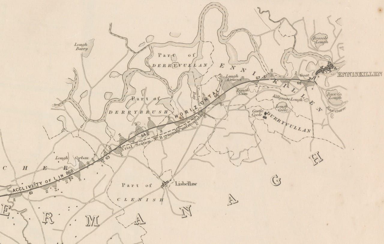
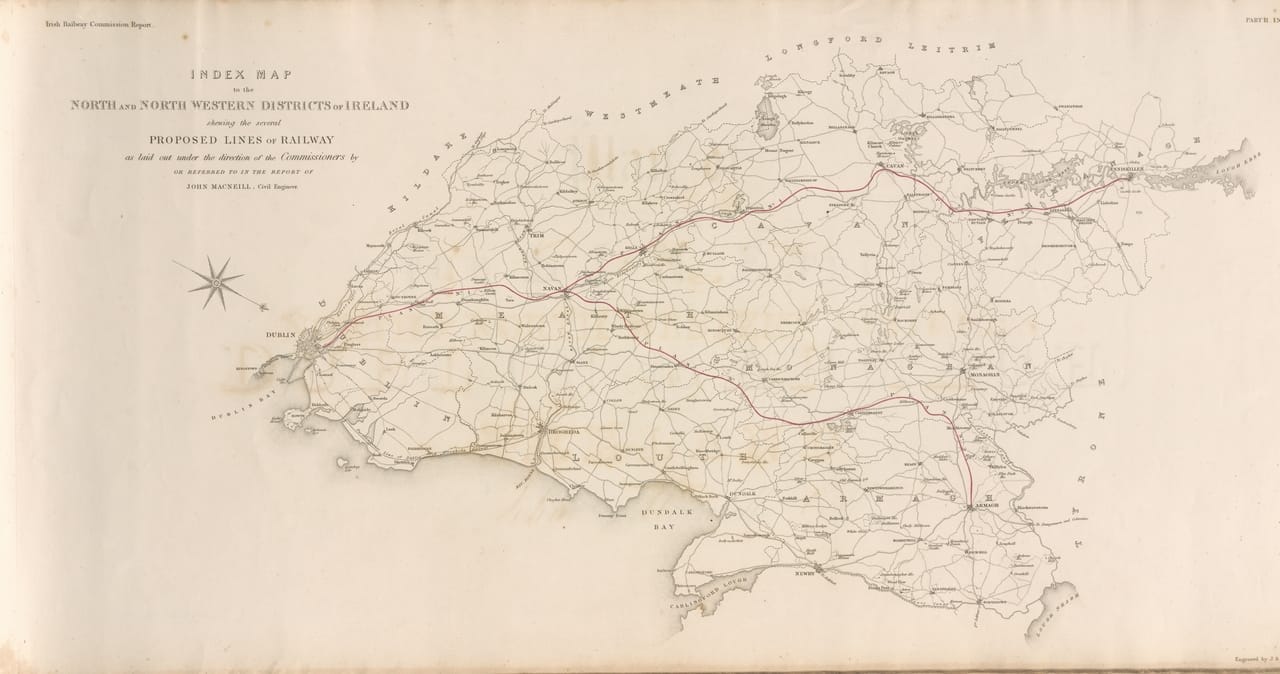
The Dublin to Armagh line had already been surveyed by John Macneill in 1836, and he was also able to take full advantage of the available Ordnance Survey of Ireland maps which had been completed at a detailed scale of six inches to one mile. The effect was that his routes were precise, their maps limited to either side of the track line. Macneill’s proposed route was to start at the north side of the Royal Canal and serve Navan, Carrickmacross, Castleblayney and Armagh. A branch line from Navan connected with Enniskillen via Cavan (9.2). Macneill illustrated his proposed routes with the most advanced methods in draughtsmanship. He used shading to communicate the depth, length, and width of cuttings and embankments, a technique known as Sectio-Planography (9.3). Plan and section are combined into one diagram, with cuttings into the earth represented by vertical lines, and embankments of built-up earth drawn with horizonal lines. Each outermost ‘tip’ had a number which showed in feet the vertical dimensions to be cut into or built up from the ground. Macneill championed this mode of visually communicating uneven land: ‘they are here, as in nature, in intimate union’.

9.2 Plans of the Several Railway Lines in Ireland, Railway Commission, 1837 (IAA Institution of Engineers of Ireland Collection 2005/95.5381). Index map showing northern lines
9.3 Plans of the Several Railway Lines in Ireland, Railway Commission, 1837 (IAA Institution of Engineers of Ireland Collection 2005/95.5381). Detail from ‘Part II, Plan V, Cavan to Enniskillen’
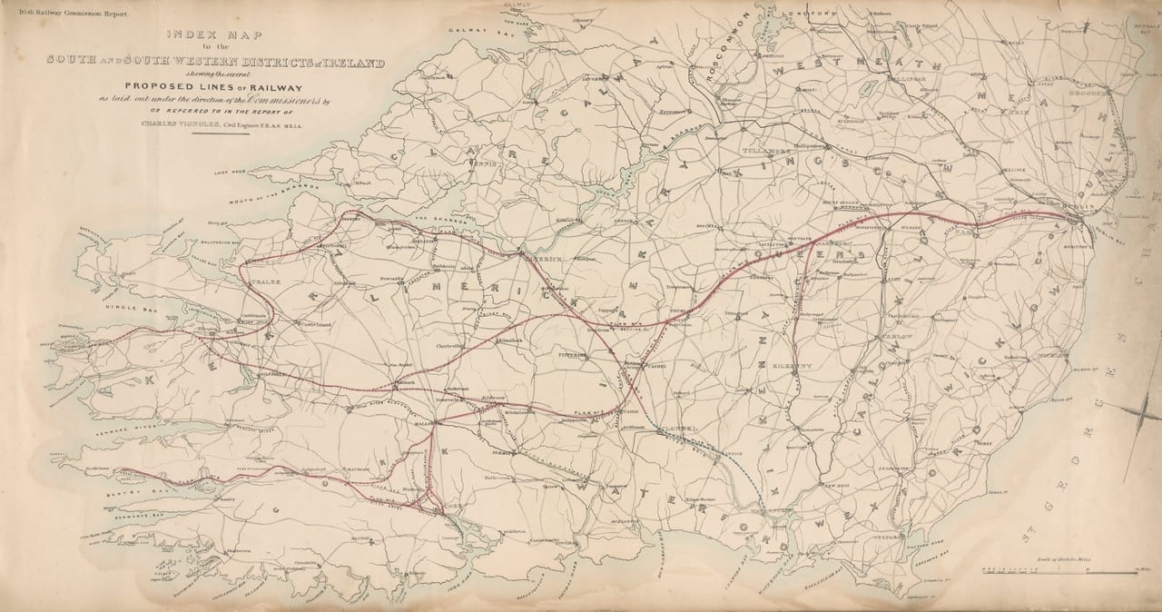
9.4 Plans of the Several Railway Lines in Ireland, Railway Commission, 1837 (IAA Institution of Engineers of Ireland Collection 2005/95.5381). Index map showing southern and south-western lines

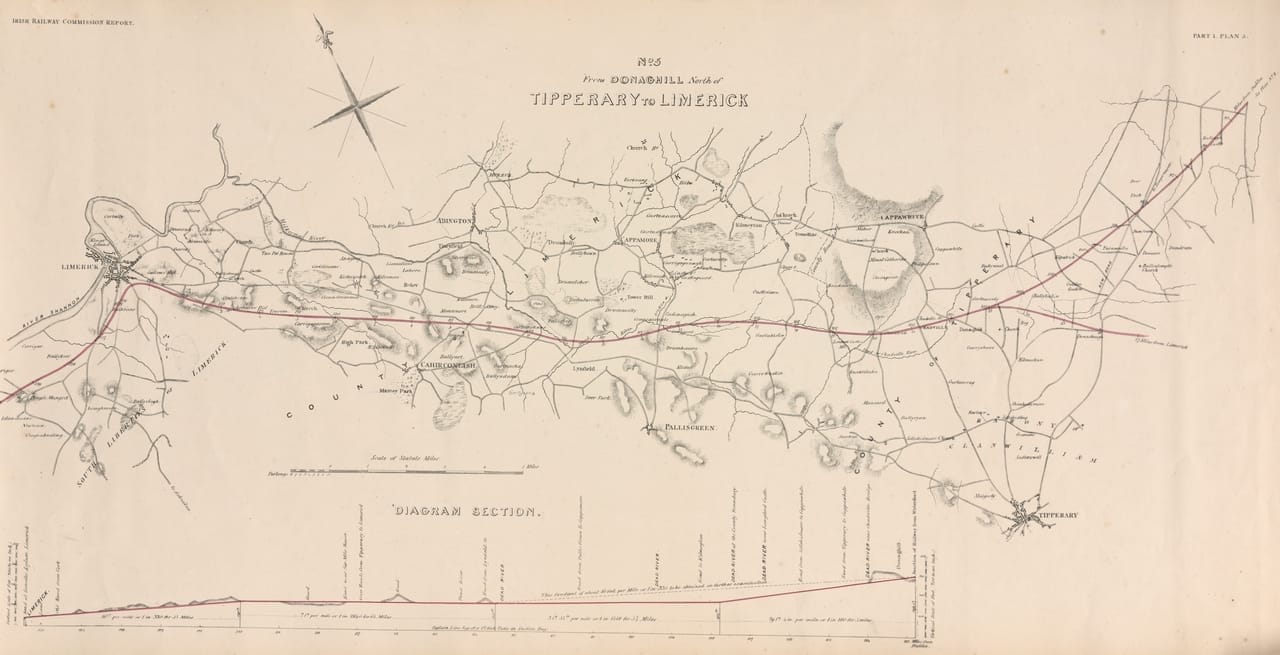
Vignoles did not use this technique, choosing instead to place cross-sections of the undulating landscape underneath the maps. His south and south-western route was also rather more complicated than the northern route (9.4). He proposed a main trunk line from Dublin to Holycross, Co. Tipperary. From there, separate branch lines would sprout: from Holycross to Limerick; to Cork; to Bantry Bay and Berehaven; to Waterford from Limerick via Clonmel; and to Kilkenny via a spur from the main trunk line at Maryborough (Portlaoise). Vignoles again highlighted the lack of accurate maps, or indeed any maps at all for some districts, remarking that his surveys undertaken were often the only correct measurement between landmarks and towns. In contrast to Macneill’s maps, those by Vignoles showed the railway line in its broader surrounding landscape (9.5). Vignoles stated that once the Ordnance Survey had been completed for the counties he surveyed, his routes of railway lines could thereafter be transferred onto those maps with the correct measurements already completed. His plans are therefore to be viewed with this in mind: the plates for the route from Dublin to Naas use the Ordnance Survey map; from Mallow to Cork, Griffith’s Geological Map was used and the absence of towns, townlands, infrastructure and buildings hamper the detailed visualisation of the suggested railway route.

9.5 Plans of the Several Railway Lines in Ireland, Railway Commission, 1837 (IAA Institution of Engineers of Ireland Collection 2005/95.5381). Detail from ‘Part I, Plan 5 Tipperary to Limerick’

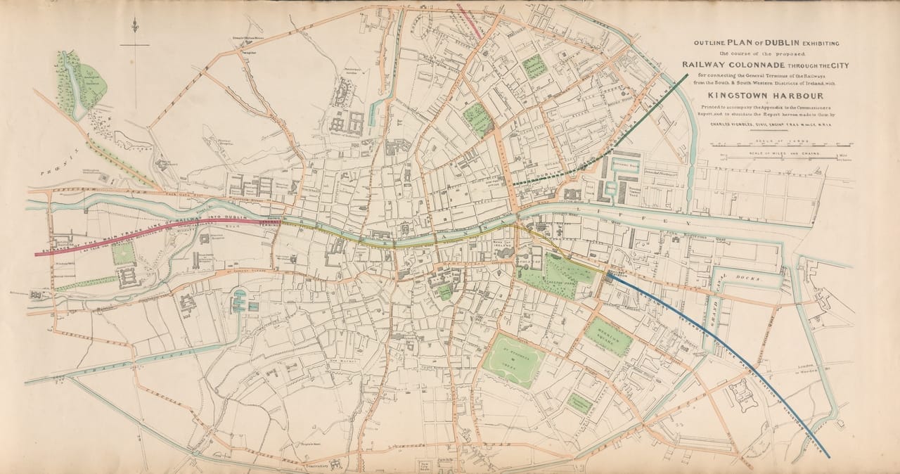
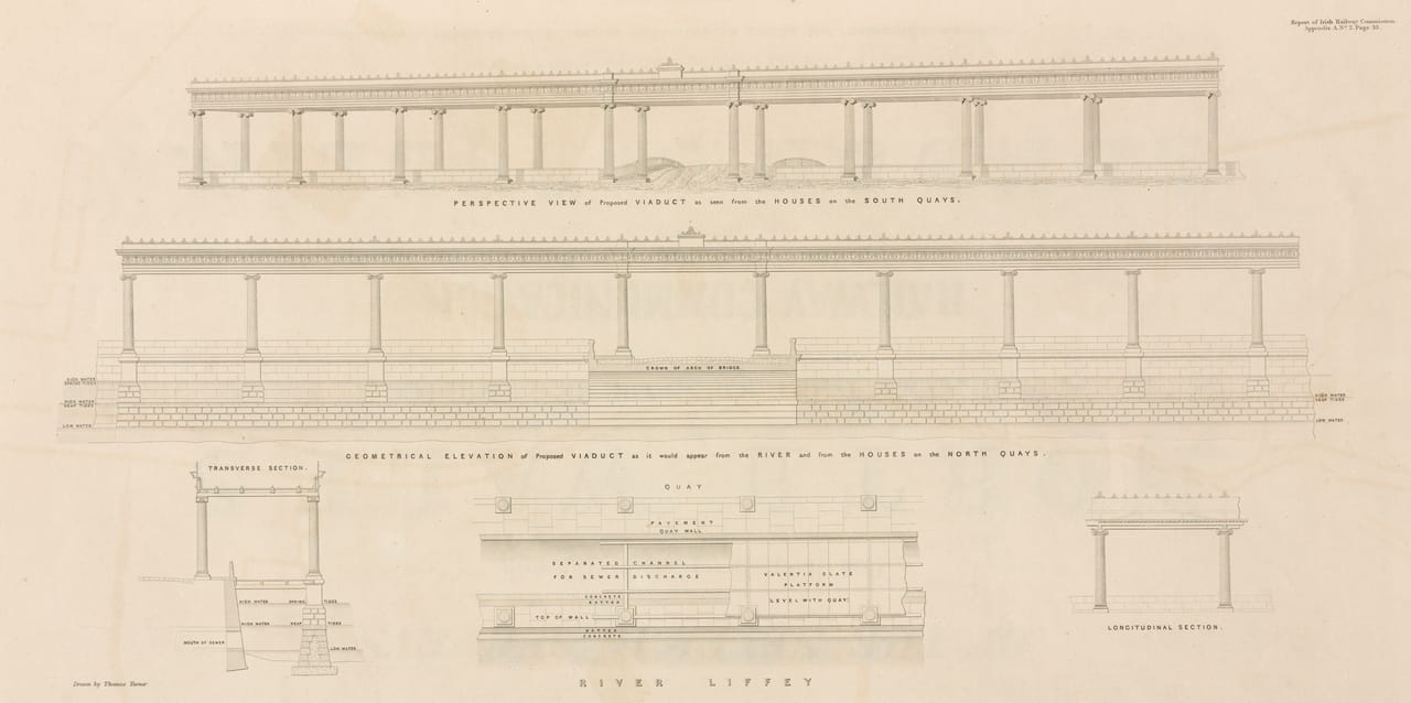
Vignoles also proposed a connection from the operational Dublin and Kingstown Railway terminus at Westland Row (now Pearse Station), which he had designed, to a proposed new station at Barrack-Bridge (later King’s Bridge, now Seán Heuston Bridge) which would act as the terminus for the southern railway routes (9.6). An elevated railway track on a colonnaded viaduct of ‘Grecian architecture of the Ionic order’ was to run the length of the southern quayside of the River Liffey, constructed completely of iron. Vignoles prepared elevation views of the proposed viaduct as seen from the houses on the south and north quays respectively, using shading to communicate the depth of the architectural details (9.7). The estimated cost of this elevated riverside railway, including purchase of houses and land, was £150,842, equivalent to €25 million today. Perhaps unsurprisingly, this was never built.

9.6 Plans of the Several Railway Lines in Ireland, Railway Commission, 1837 (IAA Institution of Engineers of Ireland Collection 2005/95.5381). ‘Outline Plan of Dublin Exhibition the course of the proposed Railway Colonnade through the City’
9.7 Plans of the Several Railway Lines in Ireland, Railway Commission, 1837 (IAA Institution of Engineers of Ireland Collection 2005/95.5381). ‘Design for the Railway Colonnade along the Quays of Dublin’

While the Railway Commissioners’ reports and Plans received public support and commendations from MPs, their proposals were never implemented. Instead, the development of railway lines in Ireland was left to private speculations, the very thing the Commissioners had set out to prevent. For the northern routes, the line was built from Dublin to Belfast, with a branch line from Navan toward Oldcastle. The line to Enniskillen branched out from Dundalk instead of Navan. Cavan was left to the Midland Great Western Railway. For the southern districts, the Great Southern and Western Railway built its lines in stages from 1844.

What is clear from the reports and the Plans is the enormity of the work undertaken to present the most advantageous development of railways in Ireland. Every aspect of trade was audited from corn mills, woollen manufacture, linen and cotton weaving, to distilleries. These documents represent the ability of a professional class of engineers, geologists, mathematicians, manufacturers, and economists. They provide a snapshot of Ireland’s social demographic and of political attitudes towards it, and highlight the contrasts between the country’s burgeoning industrial advancement and the neglected agrarian tenantry. Perhaps the most significant, and indeed lasting, outcome was the stimulation provided for the work of the Ordnance Survey which sent its entire team to Ireland to create by 1846 the first-ever large-scale map of any country. England was not fully completed to a standardised scale until the 1890s, with revisions continuing into the 1900s. The Plans and the reports they accompanied are then far more than just lines and gradients drawn across a map. Instead, they present an imagined Ireland on the cusp of industrial modernity.


Dr Siobhan Osgood is an architectural historian specialising in nineteenth-century architecture and engineering history. She is architectural historian and researcher for Fingal County Council.


Donate

Large or small, every donation helps secure the future of the collection. We are truly grateful for your support.

Donate now

Donate

Large or small, every donation helps secure the future of the collection. We are truly grateful for your support.

Donate now

Follow us

  • Facebook
  • Instagram
  • Linkedin

Address

45 Merrion Sq.
Dublin 2
D02 VY60

Contact

01 663 3040
info@irisharchitecturalarchive.ie

English | As Gaeilge

  • English

Opening Hours

Reading Room

10am-5pm, Tuesdays to Fridays; Mondays by appointment

Exhibitions

10am-5pm, Mondays to Fridays

Newsletter

Stay in touch, receive updates about exhibitions and events

Subscribe

English | As Gaeilge

Menu
  • Catalogue
  • Dictionary of Irish Architects
  • About Us
    • About
    • Board
    • Members
    • Staff
    • Annual Reports
    • Contact
  • Our Collections
    • Collections
    • Online Catalogue
  • Our Exhibitions
    • Current Exhibitions
    • Past Exhibitions
  • Our Building
    • No. 45 Merrion Square
    • Venue Hire
  • Access
    • Visit
    • Reading Room
  • Support us
    • Donate
    • Major Sponsors
Search this site

Subscribe

* indicates required

The Irish Architectural Archive will use the information you provide on this form to send you its regular Newsletter. Please confirm that you would like to hear from us:

You can change your mind at any time by clicking the unsubscribe link in the footer of any email you receive from us, or by contacting us at info@iarc.ie. We will treat your information with respect. By clicking below, you agree that we may process your information in accordance with these terms.

We use Mailchimp as our marketing platform. By clicking below to subscribe, you acknowledge that your information will be transferred to Mailchimp for processing. Learn more about Mailchimp's privacy practices.

  • English